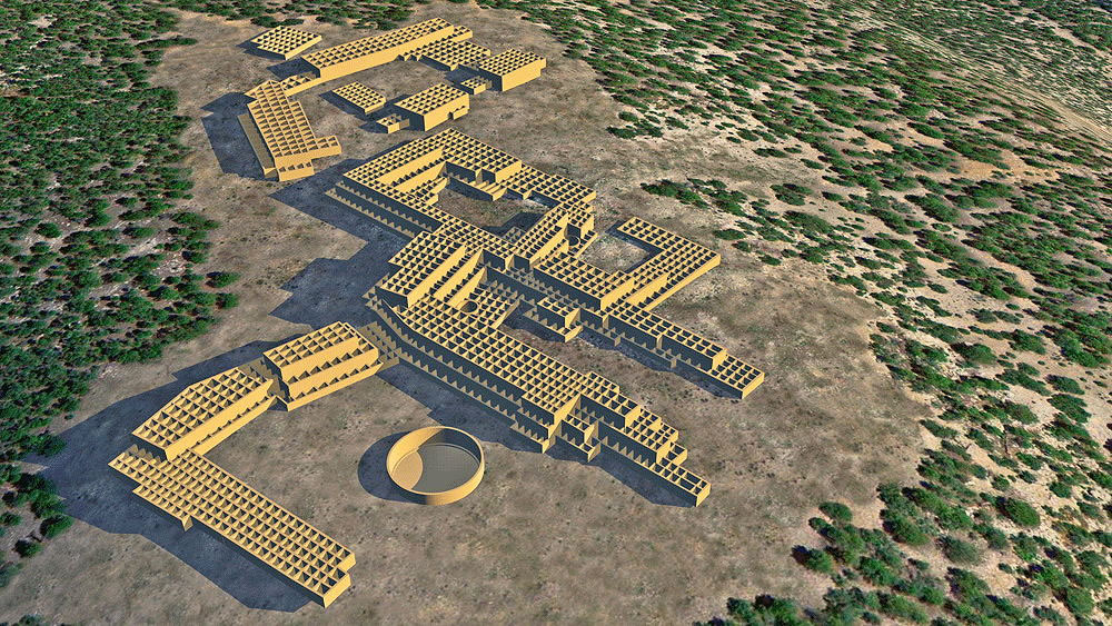
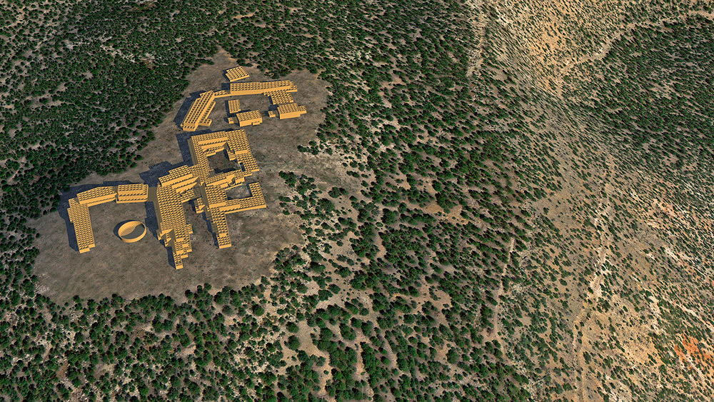
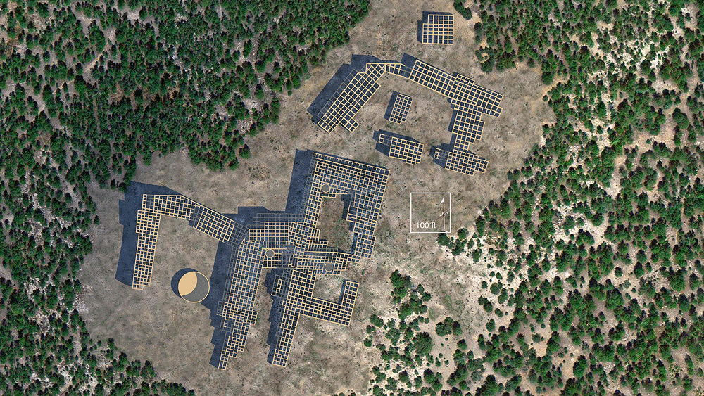
Kwastiyukwa ("Giant Footprint Ruin")

Above: Panorama of Kwastiyukwa site, photo by www.otherhand.org.
Towa Culture, Ancestral Village of Jemez Pueblo, occupied from 1275 C.E. to 1680 C.E. The Pueblo ruinsis llocated on a promontory of the Jemez Mountains 600 feet above the river valley. .Although this village was occupied well into Spanish colonial period, it remained unknown to the Spanish and its location a secret. It has been called the largest pueblo ruin in the Southwest. The village was from 5 to 7 storeys in height, with perhaps 3000 rooms--almost 1/3 of a mile long.
Location coordinates: 35°45'38.9"N 106°45'15.9"W
35.760805, -106.754417
Elevation is 2317 meters (7603 feet) above sea level
Materials: stone walls, wood log roof structure, with mud/clay roof.
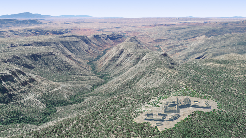
Photomontage of Kwastiyukwa Pueblo upon aerial photo of actual site in the volcanic Jemez Mountains of New Mexico. This is viewing toward the south, with the Sandia Peaks on the horizon to the upper left.
Data for CG model:
1.Published surveys on the Internet. http://www.otherhand.org/home-page/archaeology/ kwastiyukwa-ruins/
2.Scaled survey of Kwastiyukwa by (then) Jemez Pueblo archaeologist, William Whatley, personal transmission.
3. Elliot, Michael, Jemez Mountain Research Center, 1986; OVERVIEW AND SYNTHESIS OF THE ARCHEOLOGY OF THE J m E Z PROVINCE, NEW MEXICO, Museum of New Mexico Office of Archaeological Studies, Archeology Notes 51, Santa Fe.
http://www.nmarchaeology.org/assets/files/archnotes/51.pdf