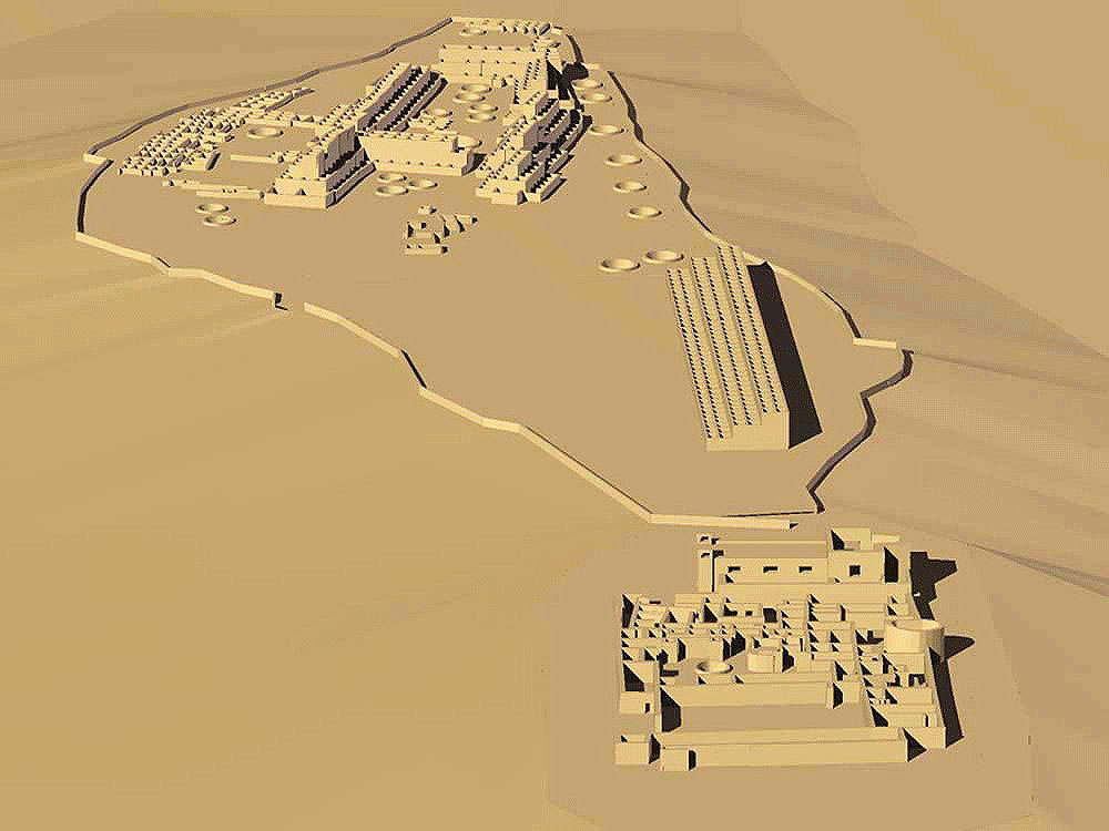
Pecos Pueblo (Towa "Cicuye" or "Cicuique", "village of 500 warriors"), Church and Convento
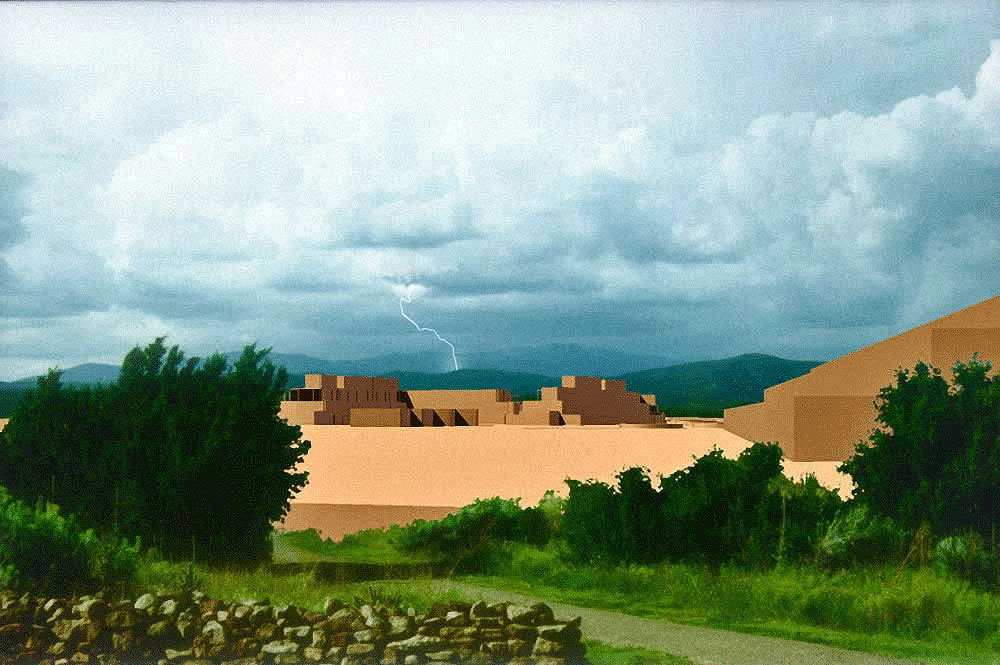
Afternoon rainstorm at the ruins of Pecos Pueblo and its mission church, Nuestra Senora de los Angeles de Porciuncula, presented in Adolphus Bandelier 1881 report, Historical Introduction to Studies Among the Sedentary Indians of New Mexico; Report on the Ruins of the Pueblo of Pecos
Papers Of The Archæological Institute Of America, American
Series, Vol. I
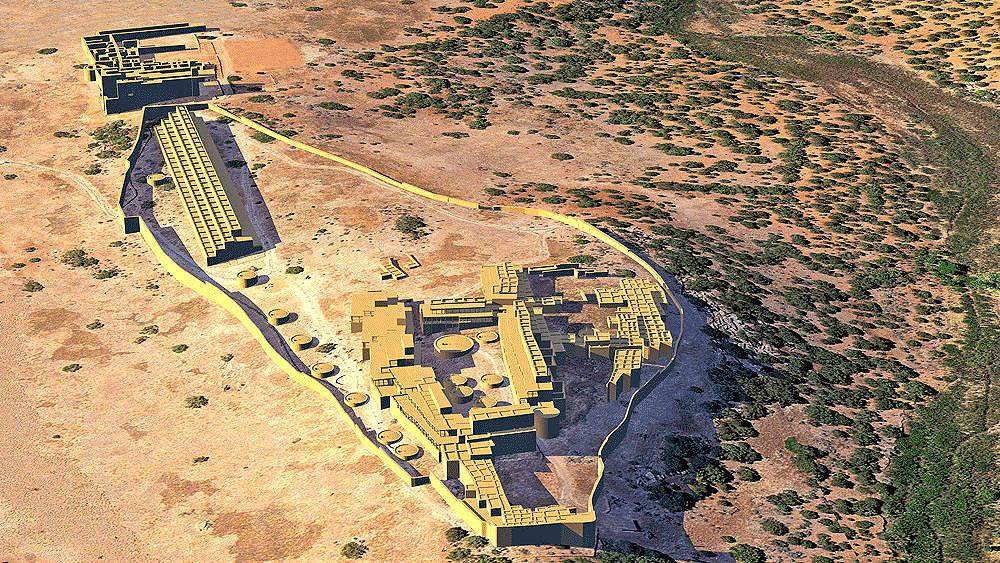
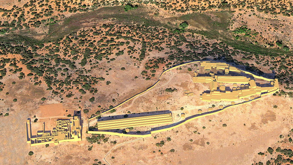
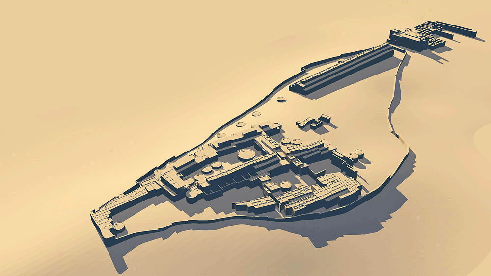
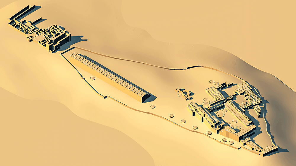
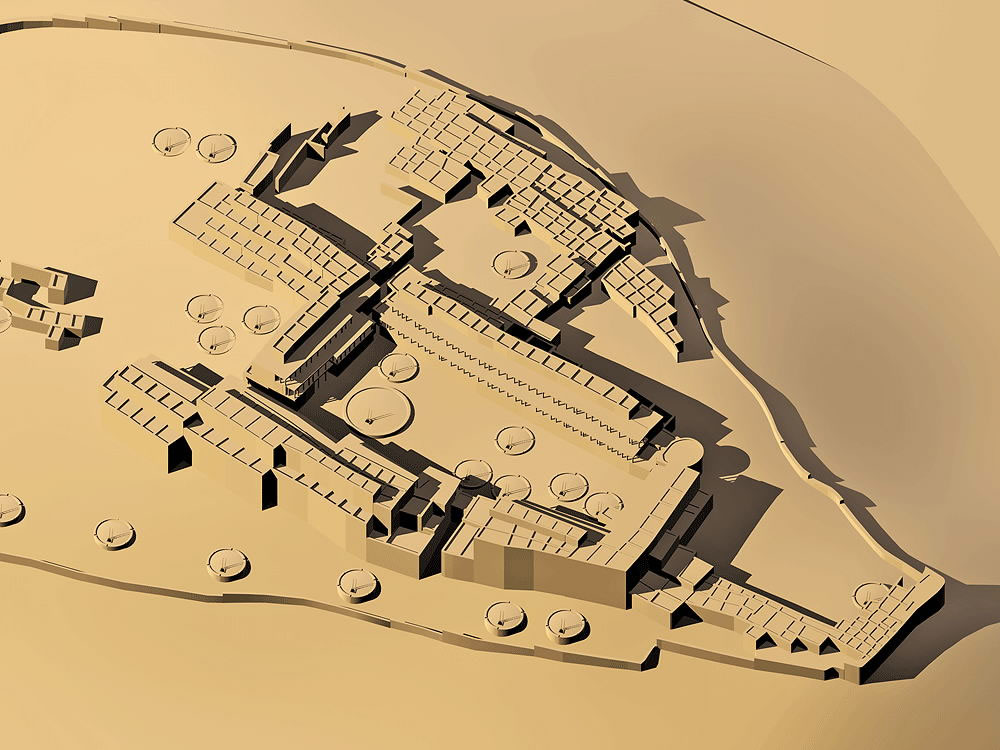
Towa Culture, Ancestral Village of Jemez Pueblo, occupied from 1325 C.E. to c.1910 C.E.; located in the Pecos National Historical Park about 27 km east of Santa Fe, New Mexico, north of Interstate 25. The Pecos Puebloans began construction of their village on a rocky ridge in 1300 C.E.. It's strategic location in the foothills of the Sangre de Cristo mountains near Glorieta Pass, east of Santa Fe, made it an important trading center between the Plains and the Pueblos. The model includes the North Pueblo, South Pueblo, and the later Hispano Church and Convento. This scaled model shows how Pecos might have looked around 1800 C.E.
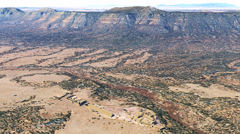
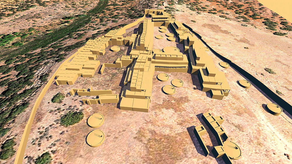
The remains of this ancient Indian place lie atop a stoney ridge about 25 miles east of present-day Santa Fe. The Pecos river is an easy walk. Pecos was located strategically near Glorieta Pass in the Sangre de Cristo Mountains between the pre-historic Rio Grande Valley agricultural trade from the west and the Plains salt-buffalo trade from the east. The Pueblo was planned as a large quadrangle with a central plaza. Begun in the 1300s, the Pueblo was, by the 16th Century Spanish arrival, four or five stories high. Covered porches on the upper levels were intricately interconnected in a "skyway" pedestrian network. The plaza level cellar rooms were about 4.4 feet high with no doors directly onto the plaza level. In the late 1500's a second roomblock was constructed south of the quadrangle. The ridgetop community architecture of the South and North Pueblos is surrounded by a 6 foot high stone wall. Outside of this wall to the south is the first Franciscan Church and Convento completed in 1625. This great Native American place is layer upon layer of prehistory and history. The Pueblo was abandoned finally in the 20th Century, and the last families to survive, moved to Jemez Pueblo, their Towa-speaking relatives, and their descendants are there to this day. A comprehensive account of the Pecos story can be found in NEE HEMISH, the History of Jemez Pueblo, by Joe S. Sando, University of New Mexico Press, Albuquerque, 1982. Willa Cather, in DEATH COMES TO THE ARCHBISHOP, tells the Pecos Pueblo story in one of America's greatest novels. Data for the computer model is from Alfred V. Kidder's excavations between 1915 and 1929.
Location coordinates: 35°33'06.0"N 105°41'18.3"W
35.551674, -105.688428
Elevation is 2123 meters (6964 feet) above sea level.
Materials: stone walls, wood log roof structure, with mud/clay roof.
Photomontage of Pecos Pueblo and the Catholic Church Mission of Nuestra Señora de Porciúncula, constructed in 1717 C.E, looking south toward the Galisteo Basin and the Sandia Mountains (Albuquerque) on the horizon.
Data for CG model:
1. Morgan, William N., 1994. ANCIENT ARCHITECTURE OF THE SOUTHWEST, University of Texas Press, Austin, Texas.
2. Kidder, Alfred V. archaeological survey documents conducted from 1915 CE to
1929 CE.
18_fs.jpg)