
Pierre's Ruins Site on the Chaco Great North Road
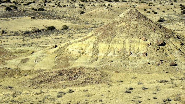
Above: Pierre's Ruins Site, view of El Faro from The Acroposlis, with the ruins of Great House P6 below left. (BLM)
Among the many mysteries of the Chaco "phenomenon" are the Chaco Roads, and particularly the construction of parallel road segments, some of which have been identified along the Great North Road that runs from Chaco Canyon's Pueblo Alto due north to Salmon Pueblo. Located on this road about 12 miles (19 kilometers — a day's walk) north of Alto is Pierre's ruins, an architectural cluster of three Great House roomblocks, kivas, lookouts, and signaling locations sited on the tops of pinnacle buttes. These rise above the plain as the most prominent landmarks between Pueblo Alto and Huerfano Mesa to the north. two of the great houses (A and B) sit on top of the central small mesa, known as "The Acropolis". To the west of the Acropolis is a pinnacle cone the top of which is a three room structure containing a hearth, and at the base is the third and largest of the site's Great House (P6 — known as El Faro — the light house). Some archaeologists believe the structure at the cone's top was a fire signaling location--an element of an Ancestral Puebloan regional long-distance communication system the utilized mirrors, fire and smoke, using line of site between Salmon Pueblo, Huerfano Mesa, Chimney Rock Pueblo, Pierre's Pueblos, and Chaco Great House, Pueblo Alto. This would have made instant messaging possible. These sites would also have been connected wtih roads, The Great North Road passed through Pierre's site just to the west of El Faro. A spur of the Road passed east up and over The Acropolis from El Faro.
Elevation is 6500 feet (1981 meters) above sea level.
Location coordinates: 36°14'35.5"N 107°56'50.7"W
36.243189, -107.947420
Materials of construction: Core and veneer sandstone from the caps of the pinnacles, ponderosa pine and white fir tree logs for roof supports, dated to 1124 CE, probably brought to the site from the La Plata Mountains, 65 miles (105 kilometers) to the north (without the use of draft animals or the wheel!).
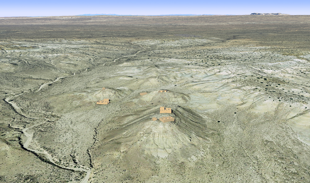
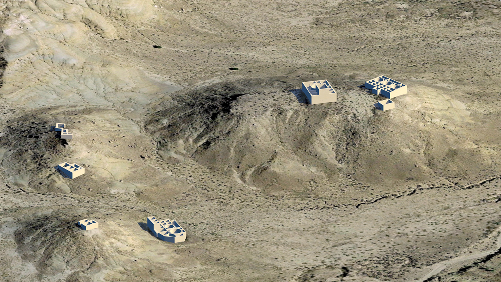
Photomontage of Pierre's Ruins Site on aerial photo of actual site, looking due north, showing "The Acropolis" in the center, Great House P6 to the left lower level, and Huerfano Mesa in the distant right horizon.
Looking north, with The Acropolis in the foreground.
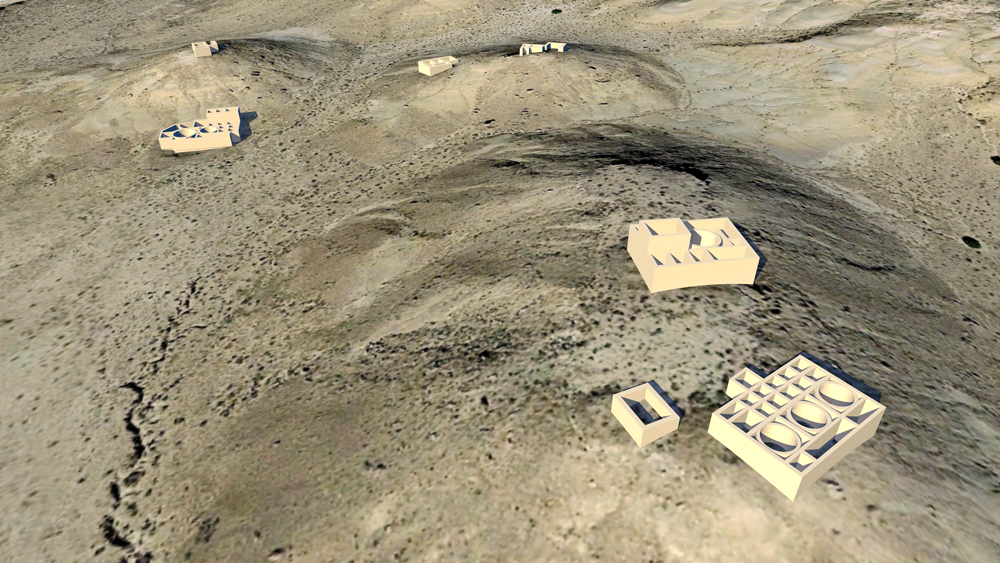
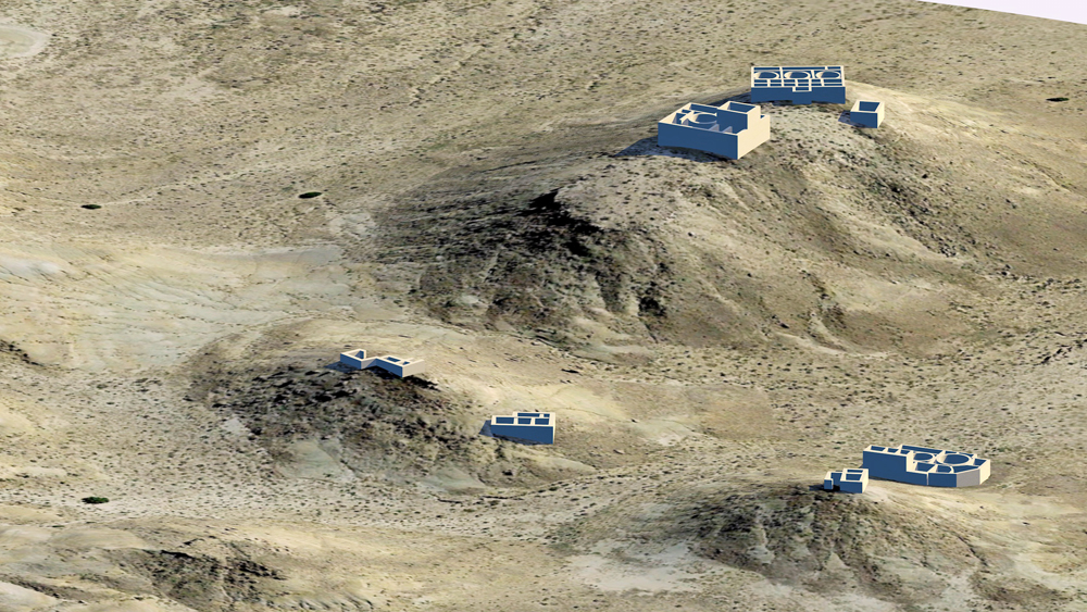
Looking northeast, with The Acropolis on the right and El Faro on the left.
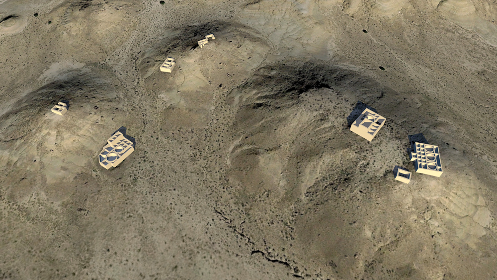
Looking east, with The Acropolis on the right and El Faro on the left.
Looking southeast, with El Faro on the right foreground and The Acropolis in the center beyond.
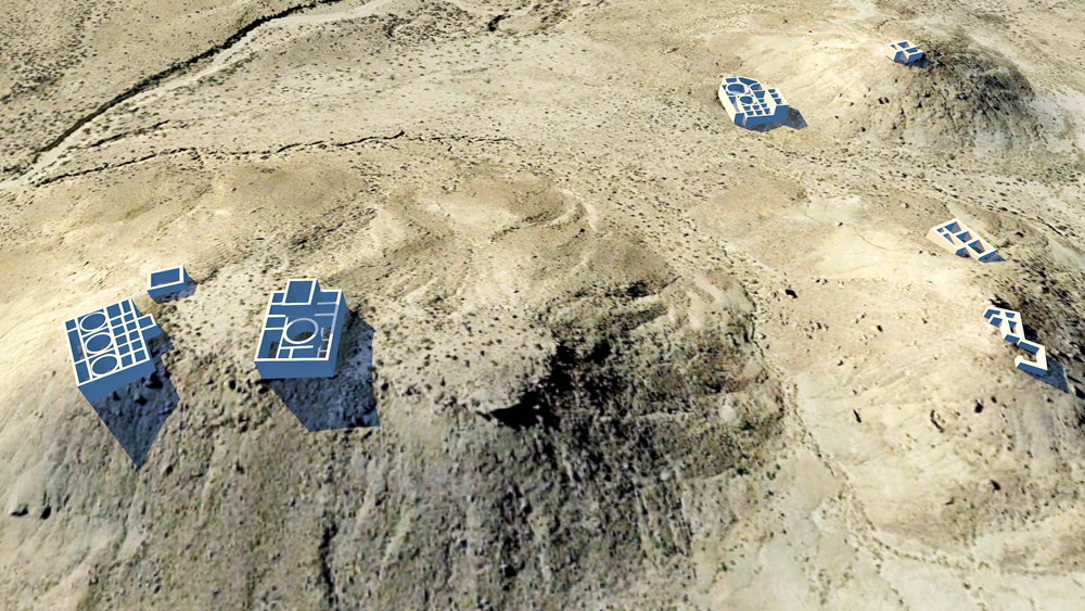
Looking west, with The Acropolis on the left and El Faro on the upper right.
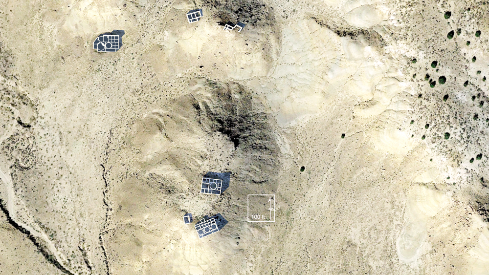
Photomontage of Pierre's Ruins Site with scale and orientation.
Sources of data for the CG model:
1. Marshall, Anne Lawrson, 1998. https://www.webpages.uidaho.edu/chaco/pierresframes.htm University of Idaho. 1998.
2. Powers, Robert P. and Gillespie, William B. and Lekson, Stephen H., 1983. THE OUTLIER SURVEY, A REGIONAL VIEW OF SETTLEMENTIN THE SAN JUAN BASIN, Reports of the Chaco Center, Number Three, Division of Cultural Research, National Park Service, U.S. Department of the Interior, Albuquerque, New Mexico, 1983.
3. Kantner, John (date unknown). Chaco Roads, in Archaeology Southwest: https://www.archaeologysouthwest.org/wp-content/uploads/Chaco-Roads.pdf